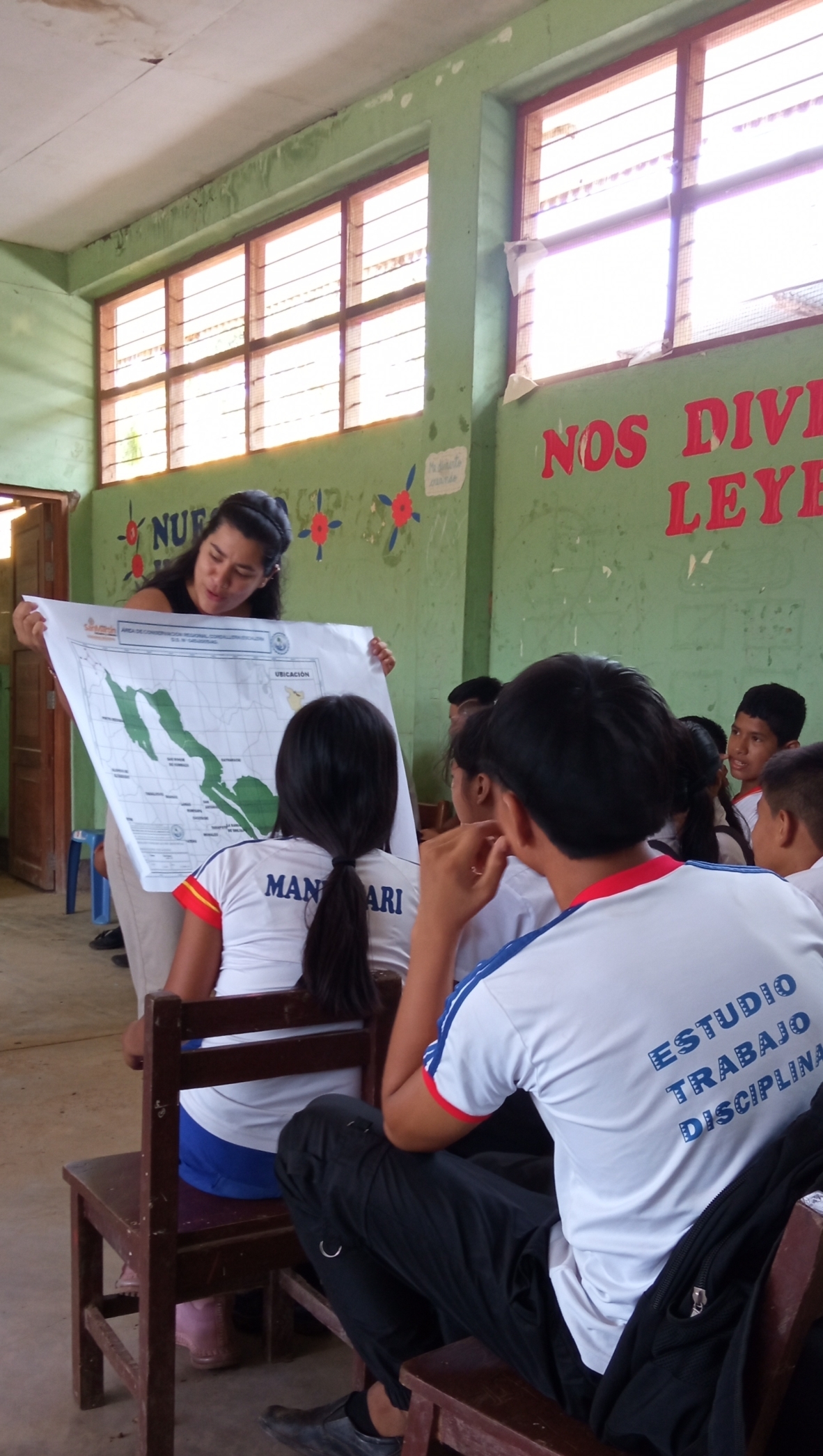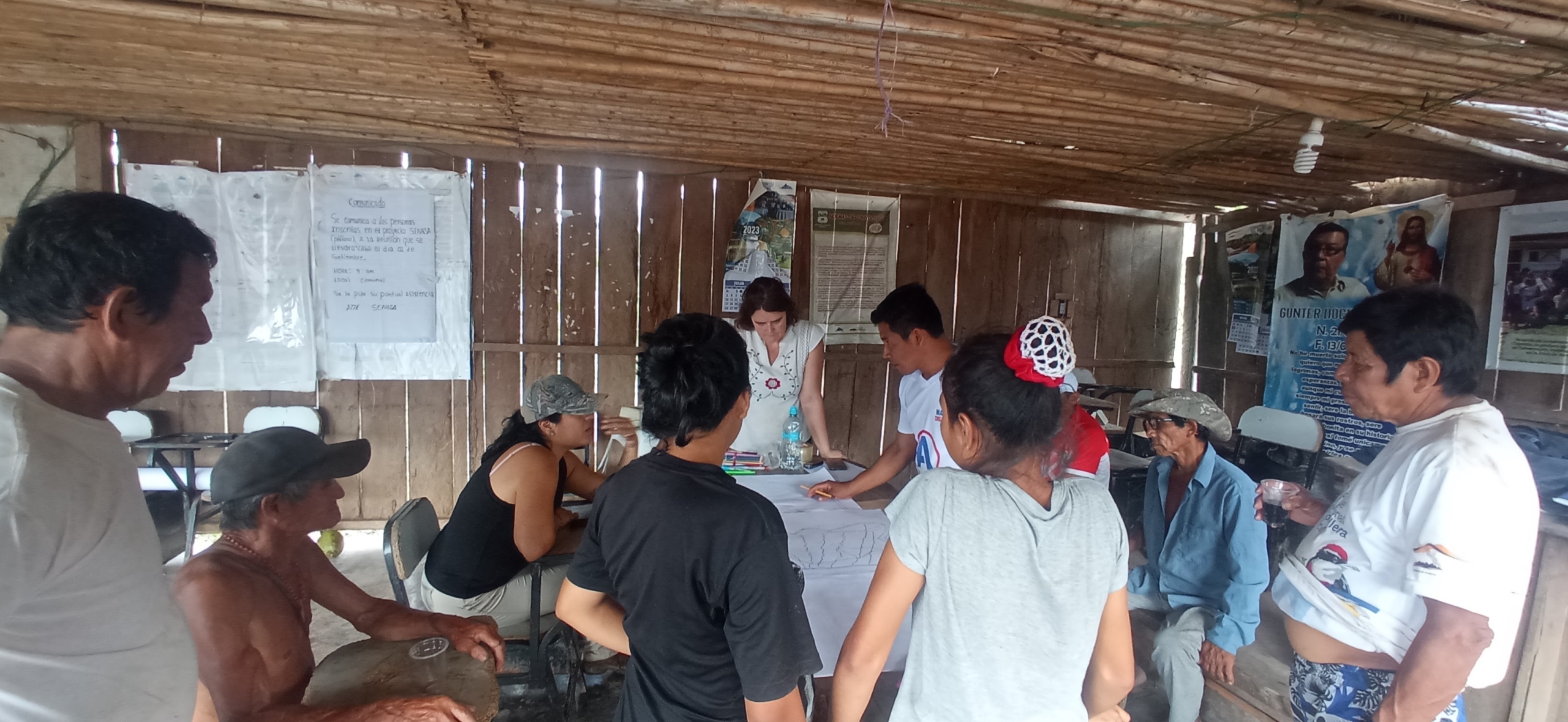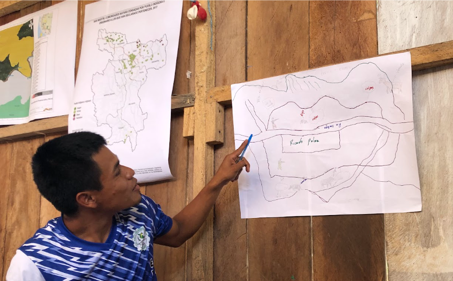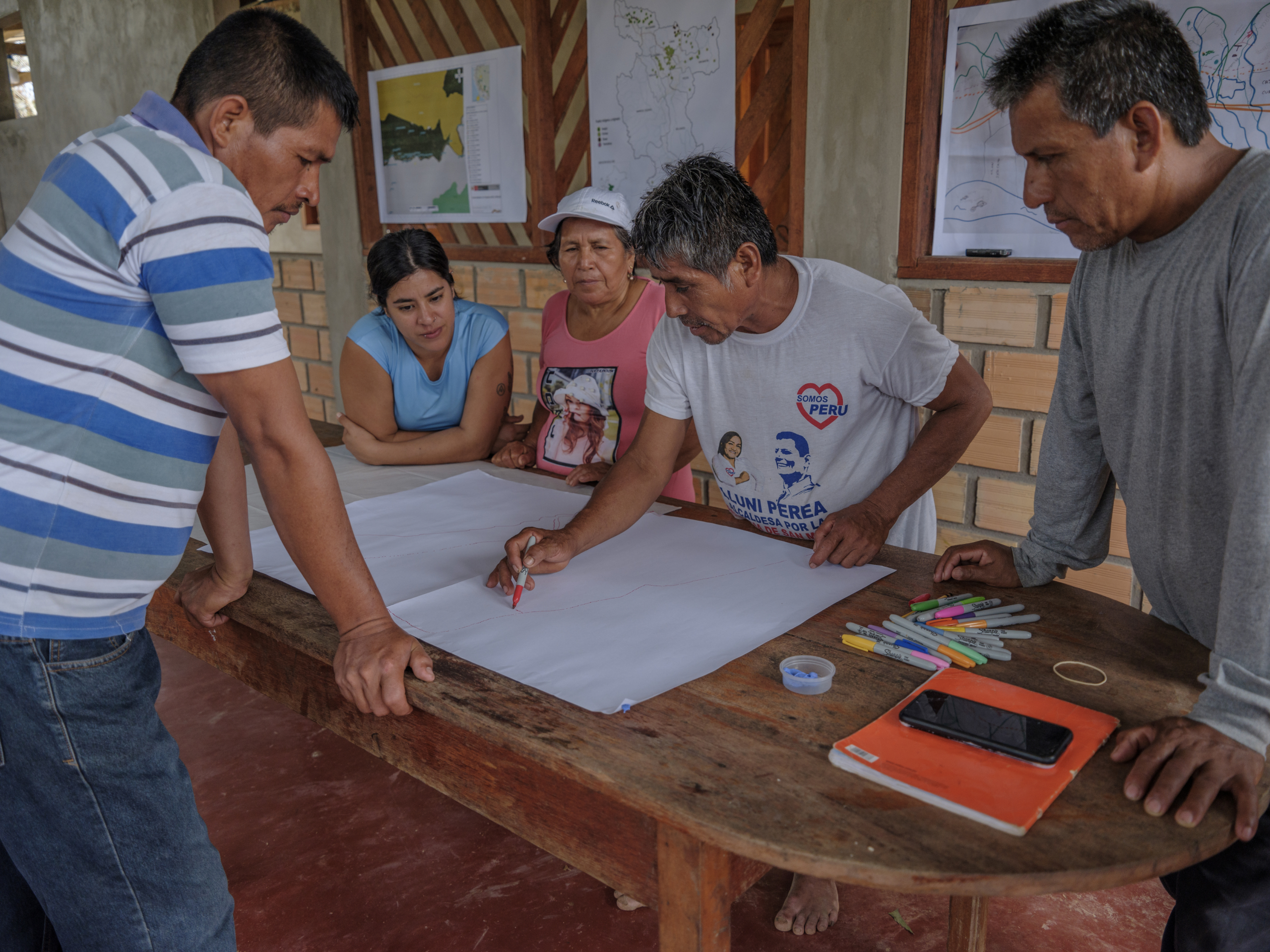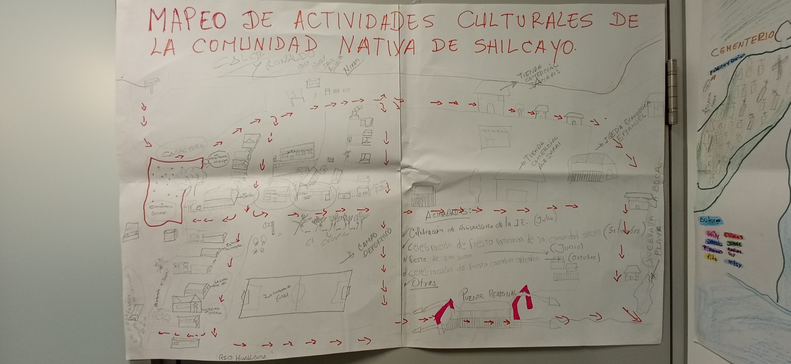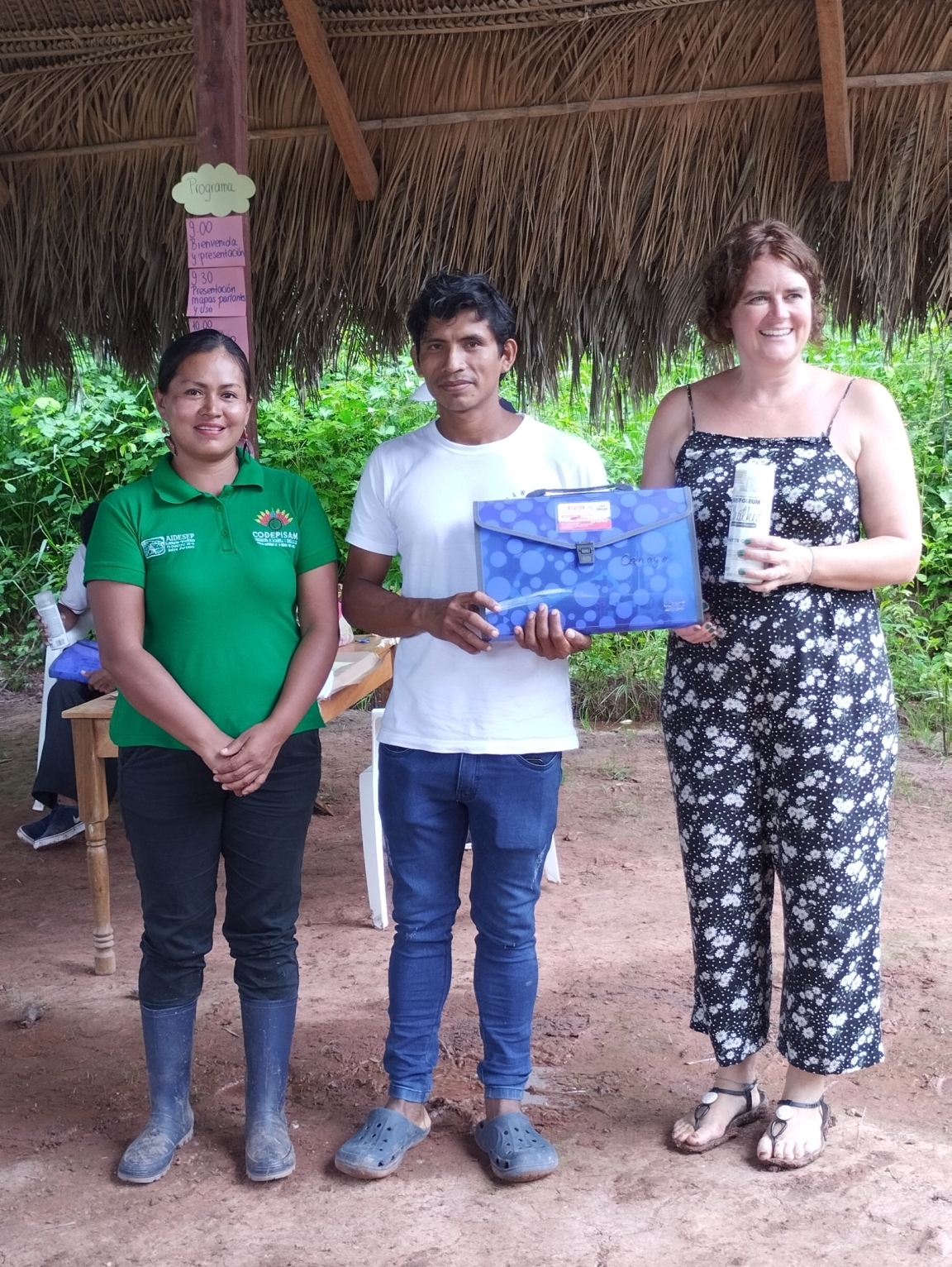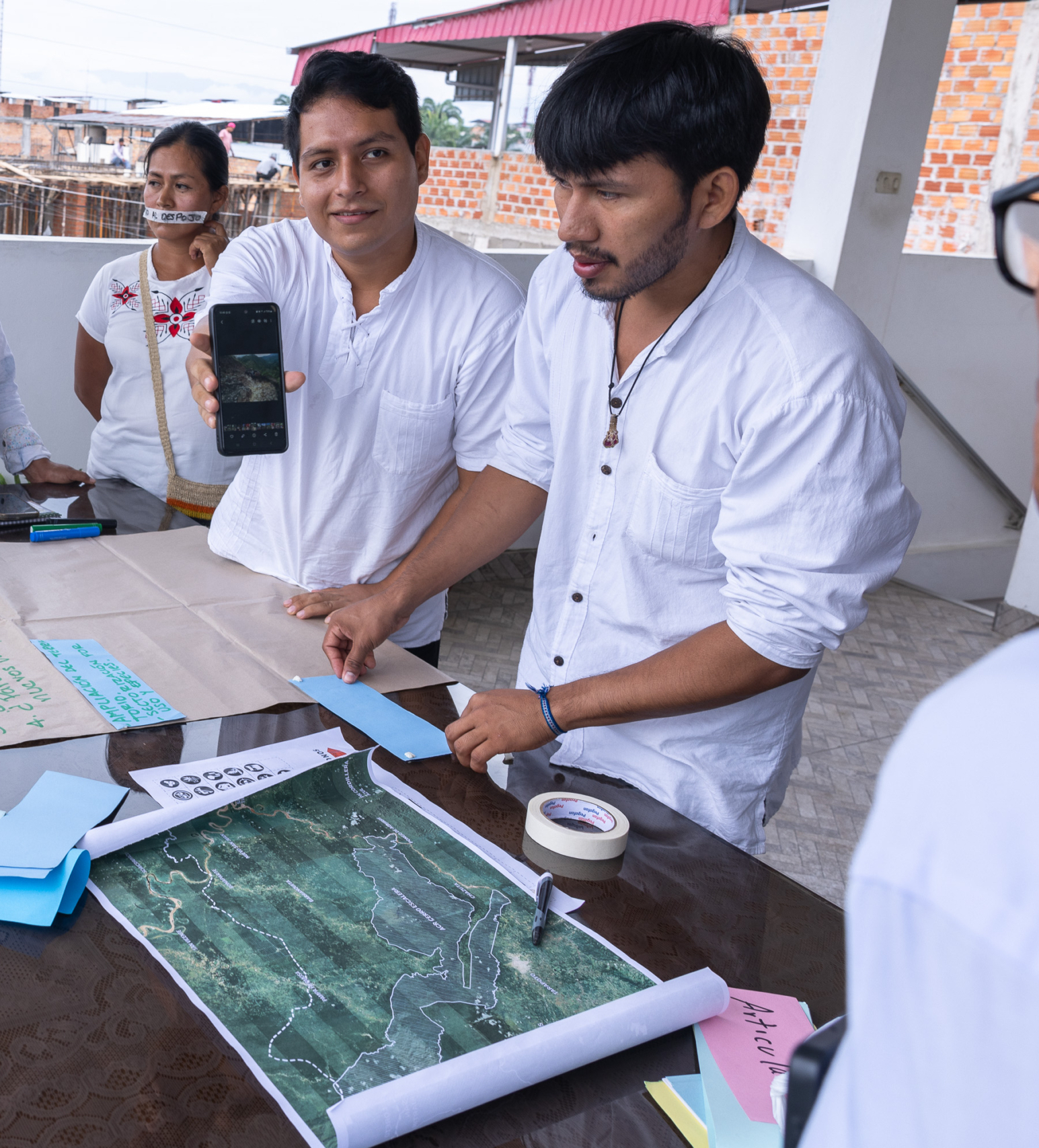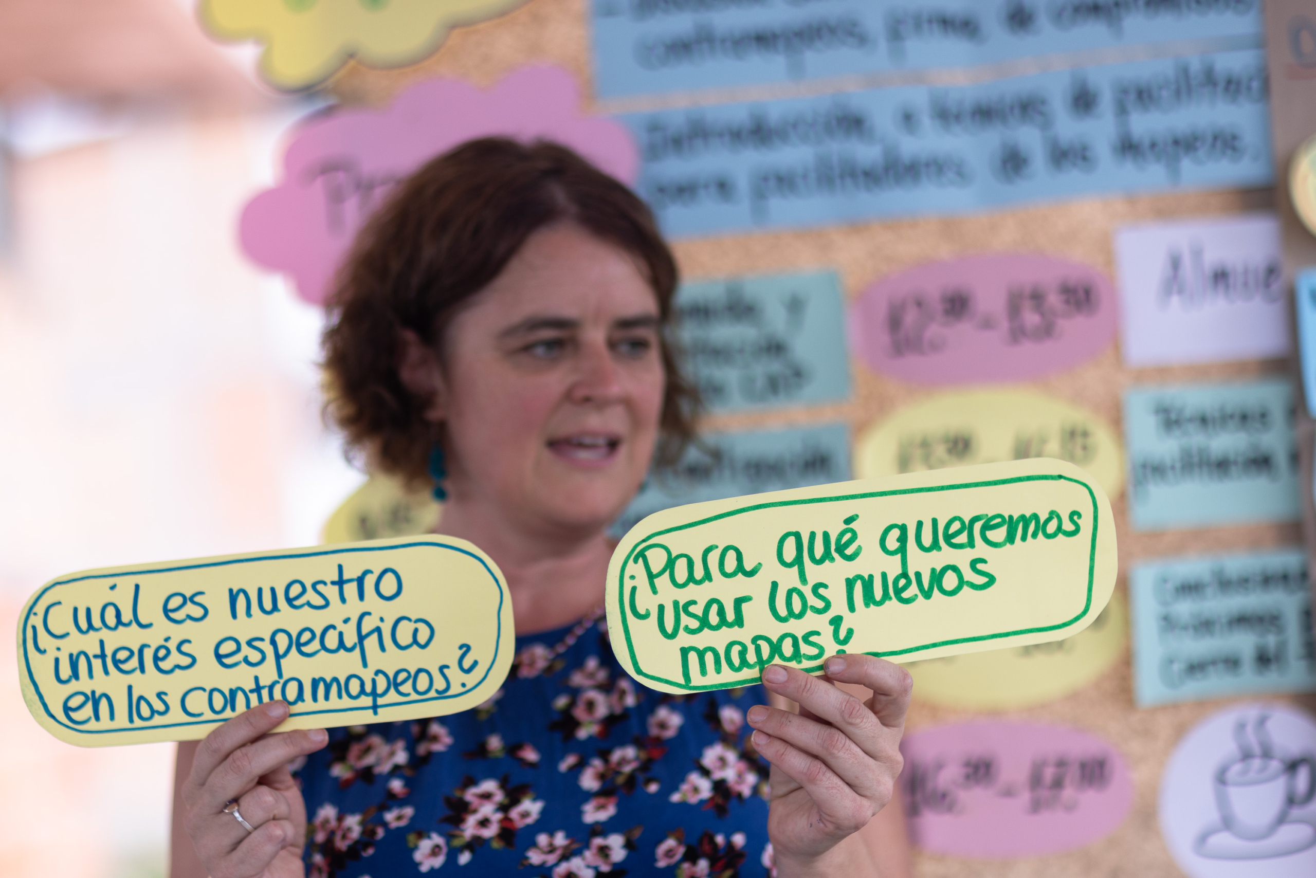
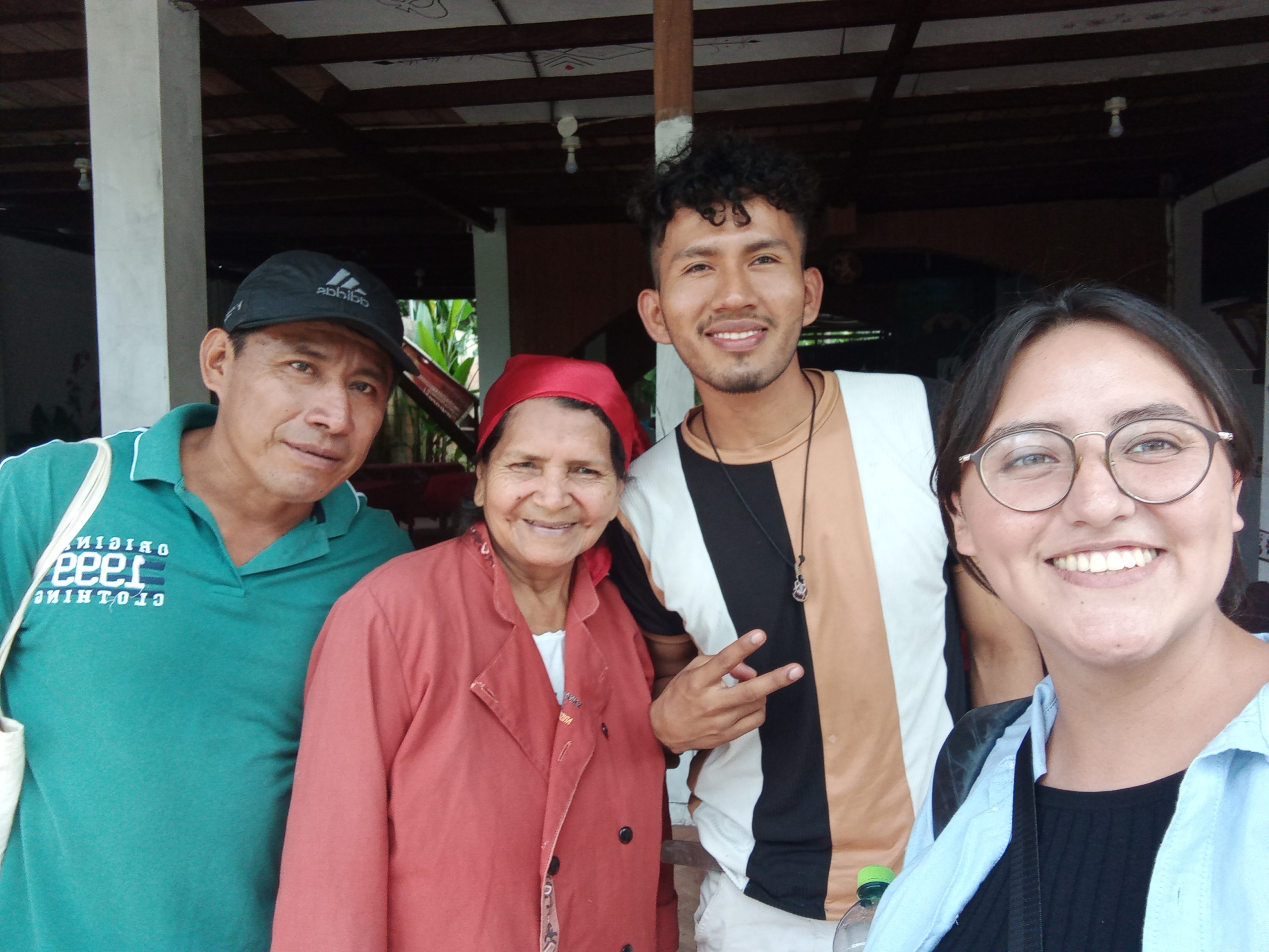
Taller subnacional del proyecto en San Martín con organizaciones indígenas regionales y nacionales (CODEPISAM, AIDESEP, ONAMIAP). Lamas, Septiembre 2023. Créditos: Valeria Soldevilla

Taller subnacional del proyecto en San Martín con organizaciones indígenas regionales y nacionales (CODEPISAM, AIDESEP, ONAMIAP). Lamas, Septiembre 2023. Créditos: Valeria Soldevilla

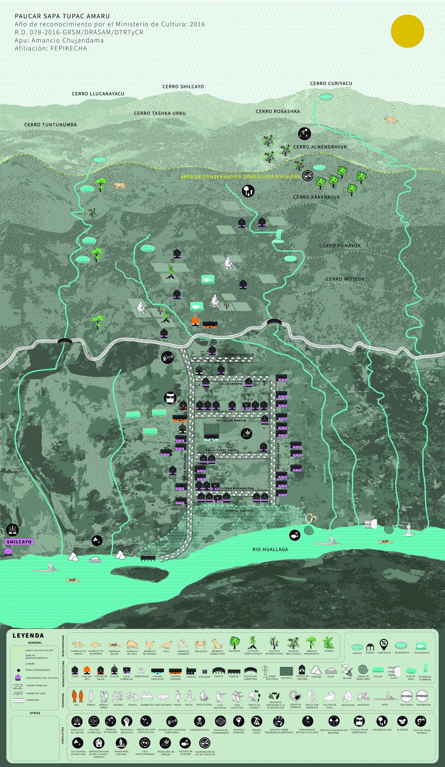
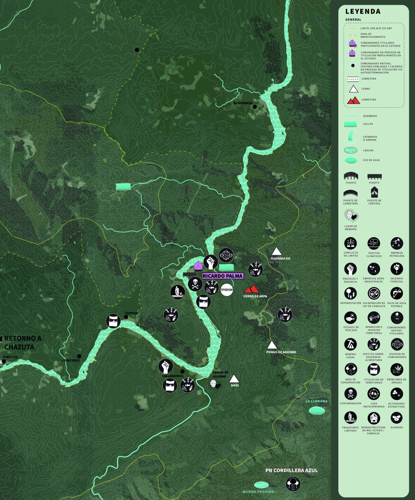
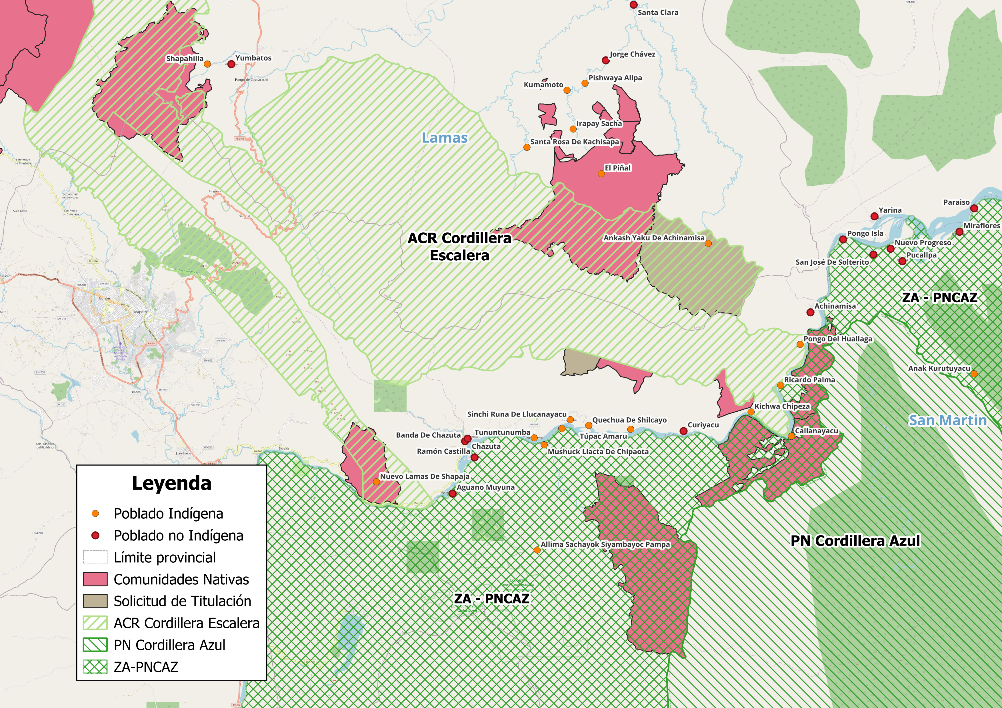
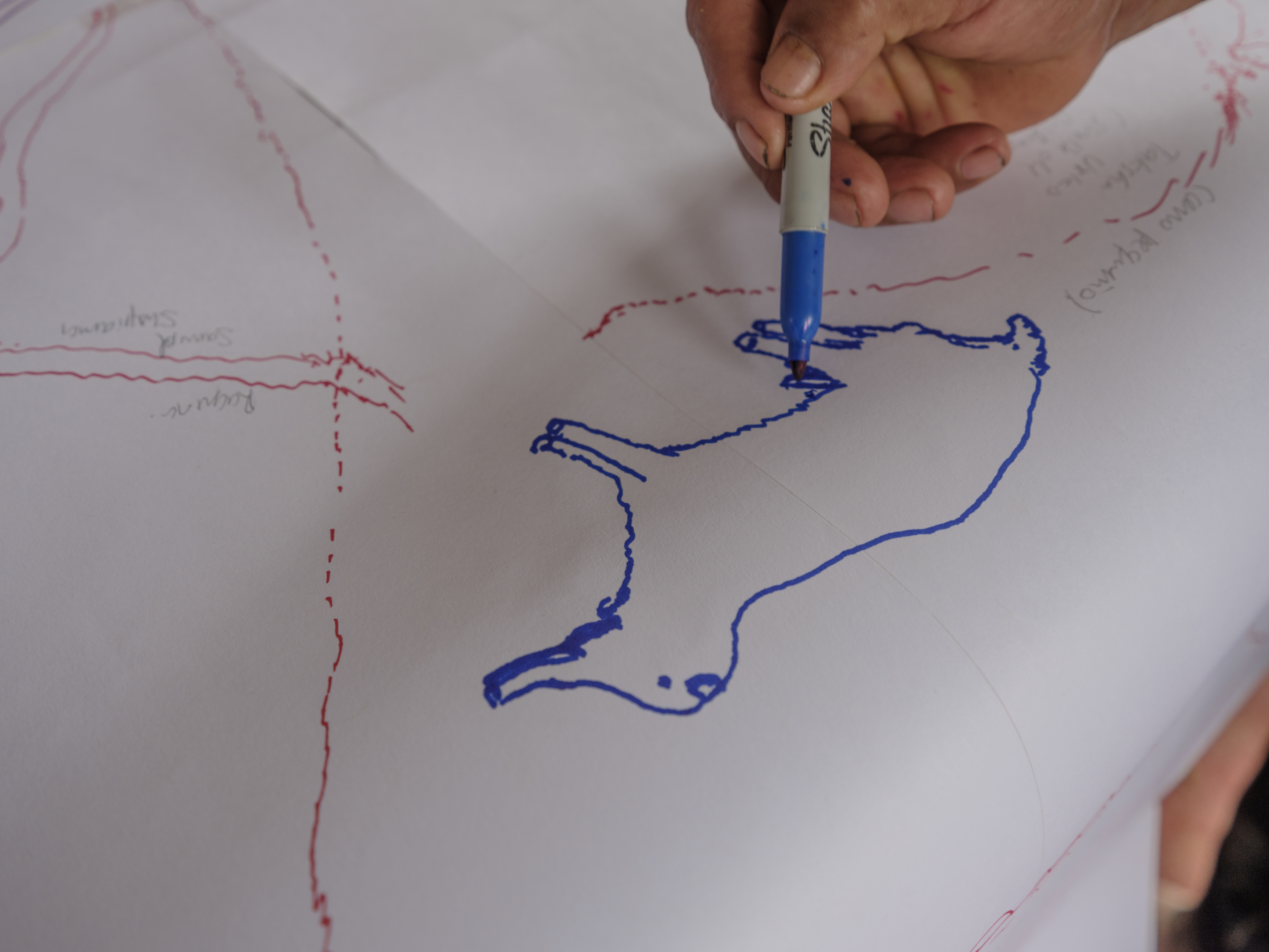
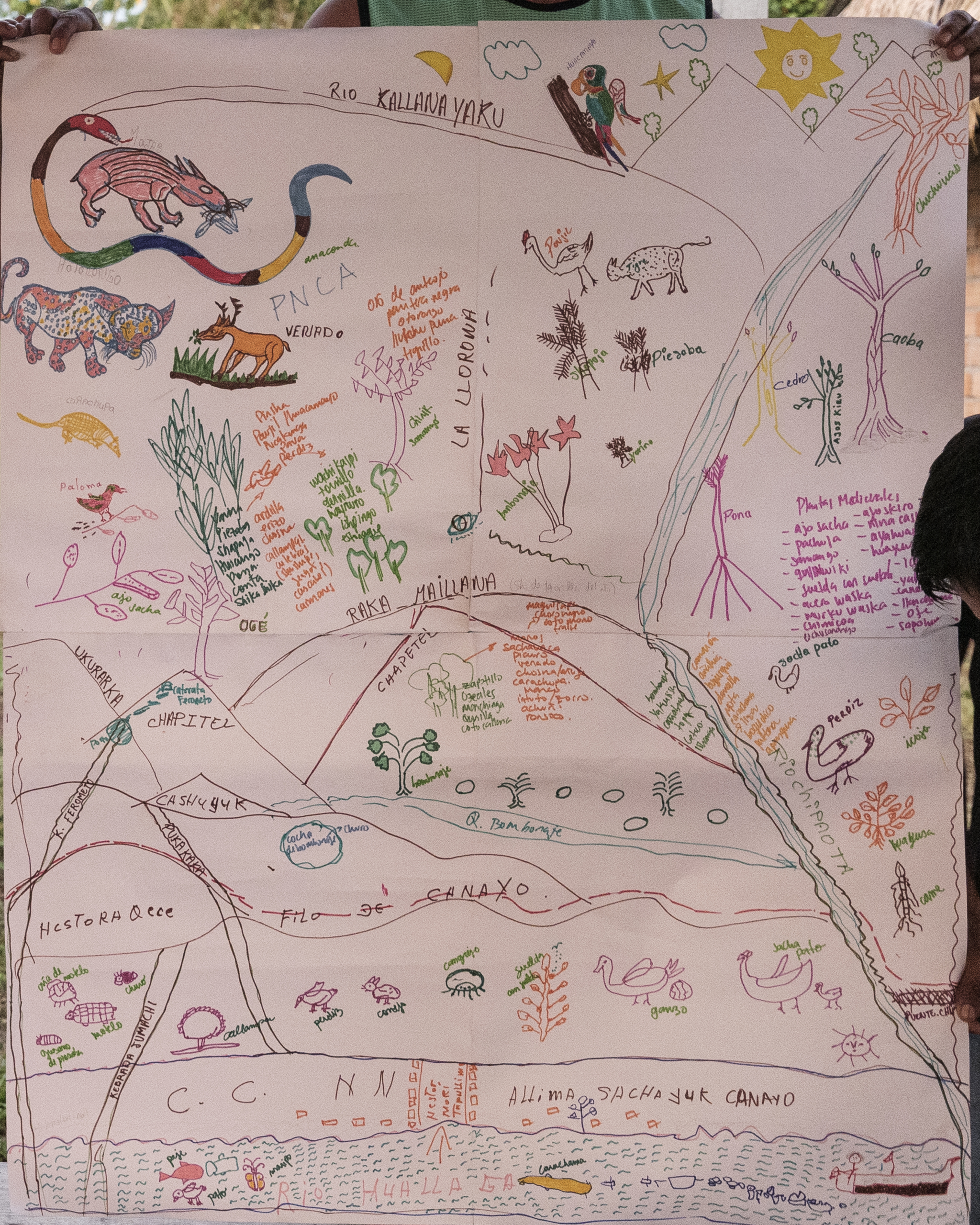
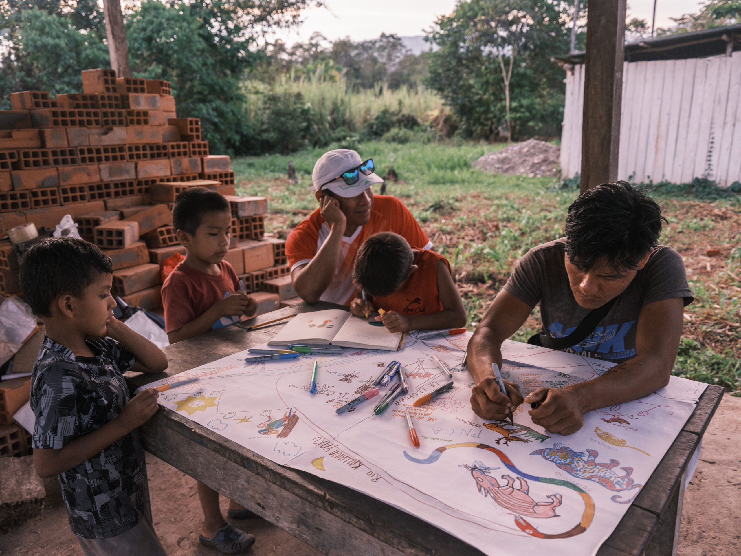
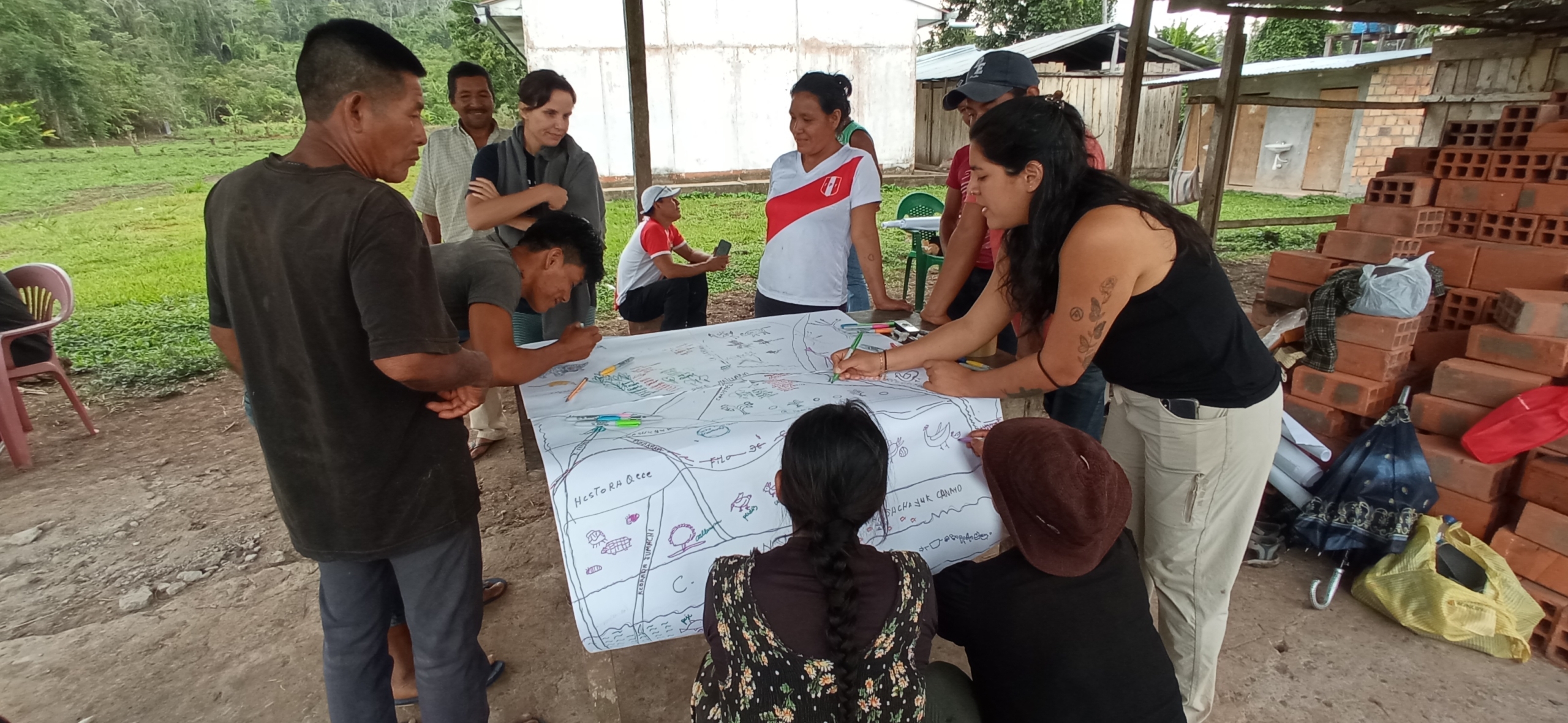
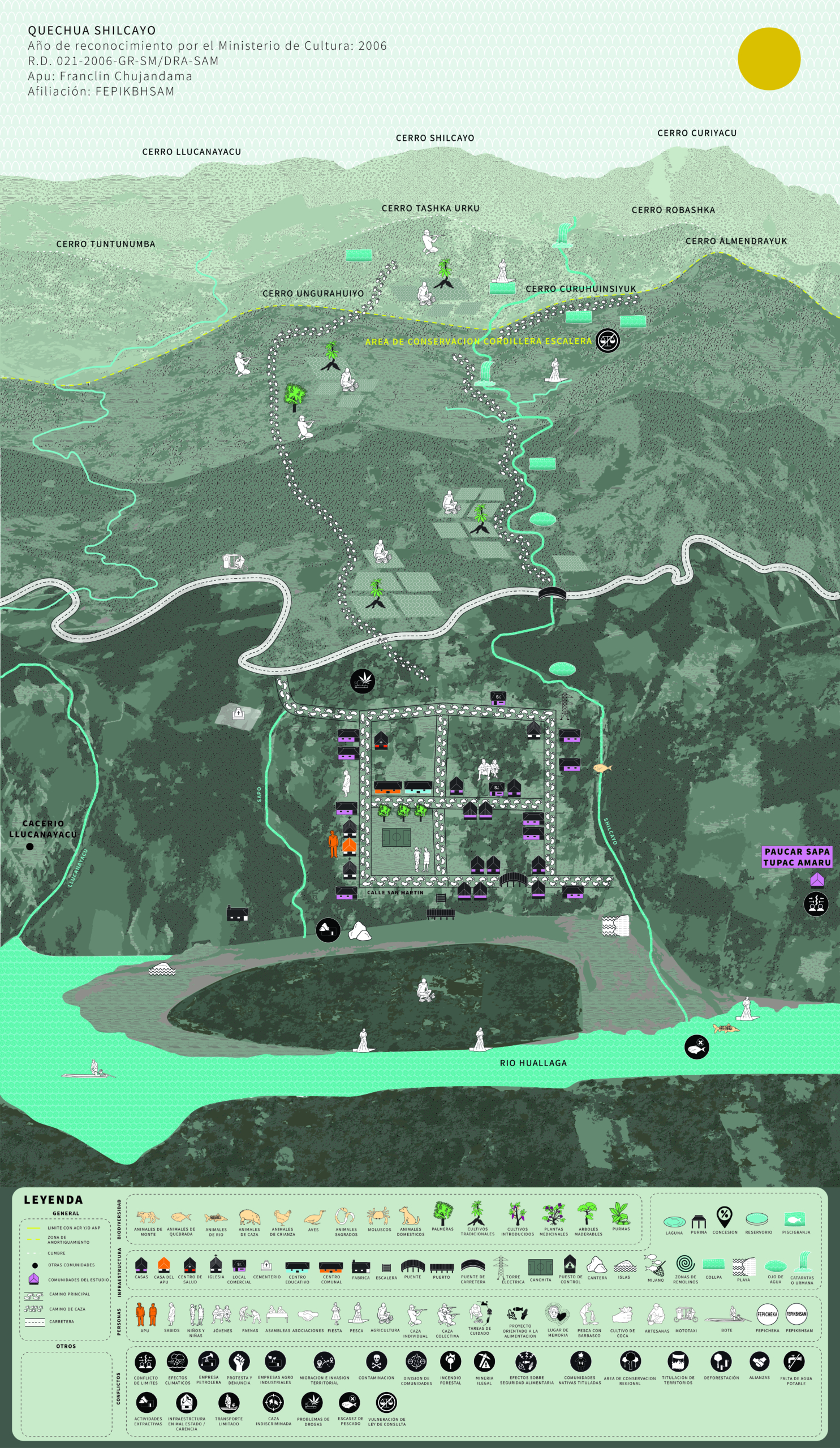
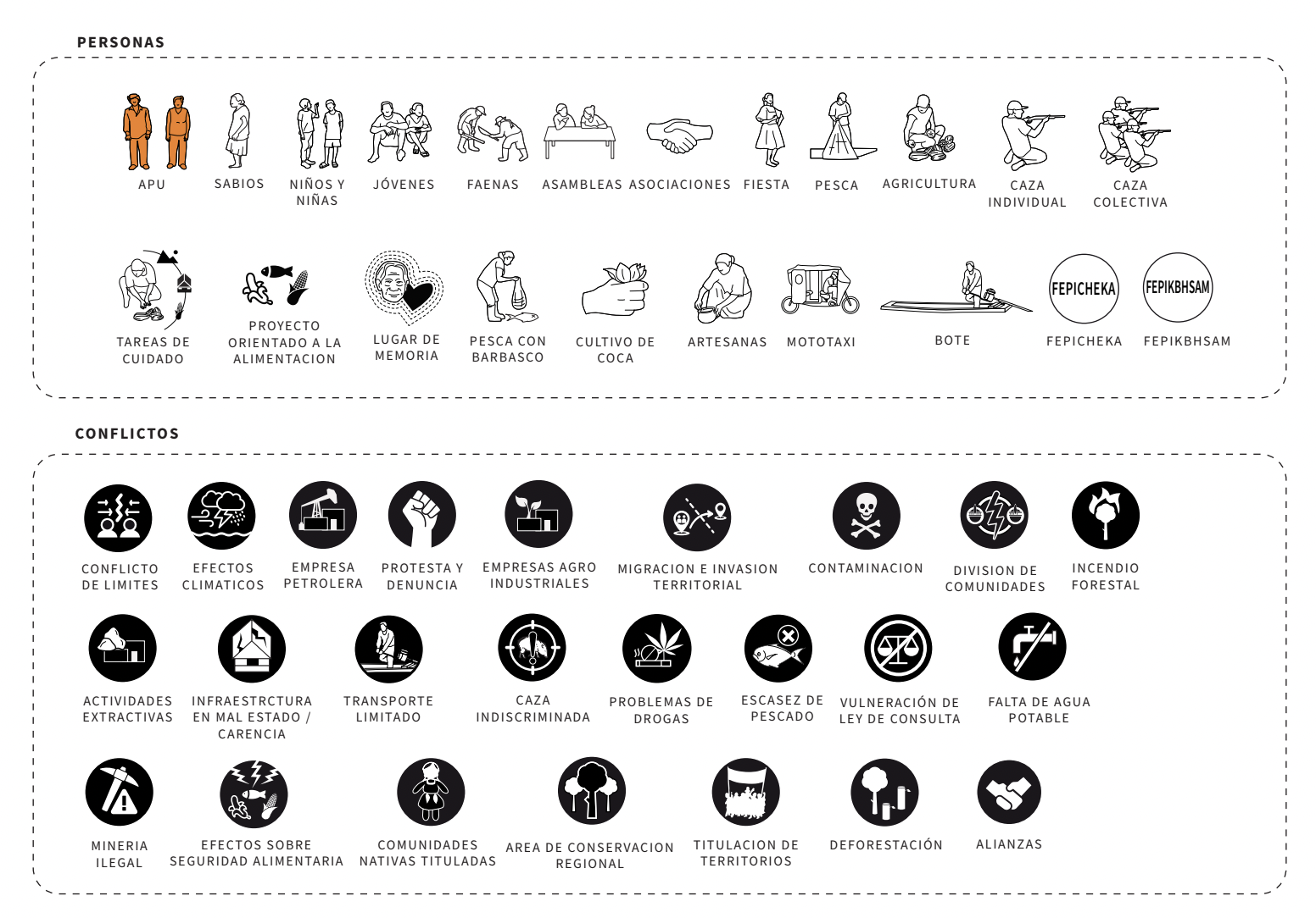
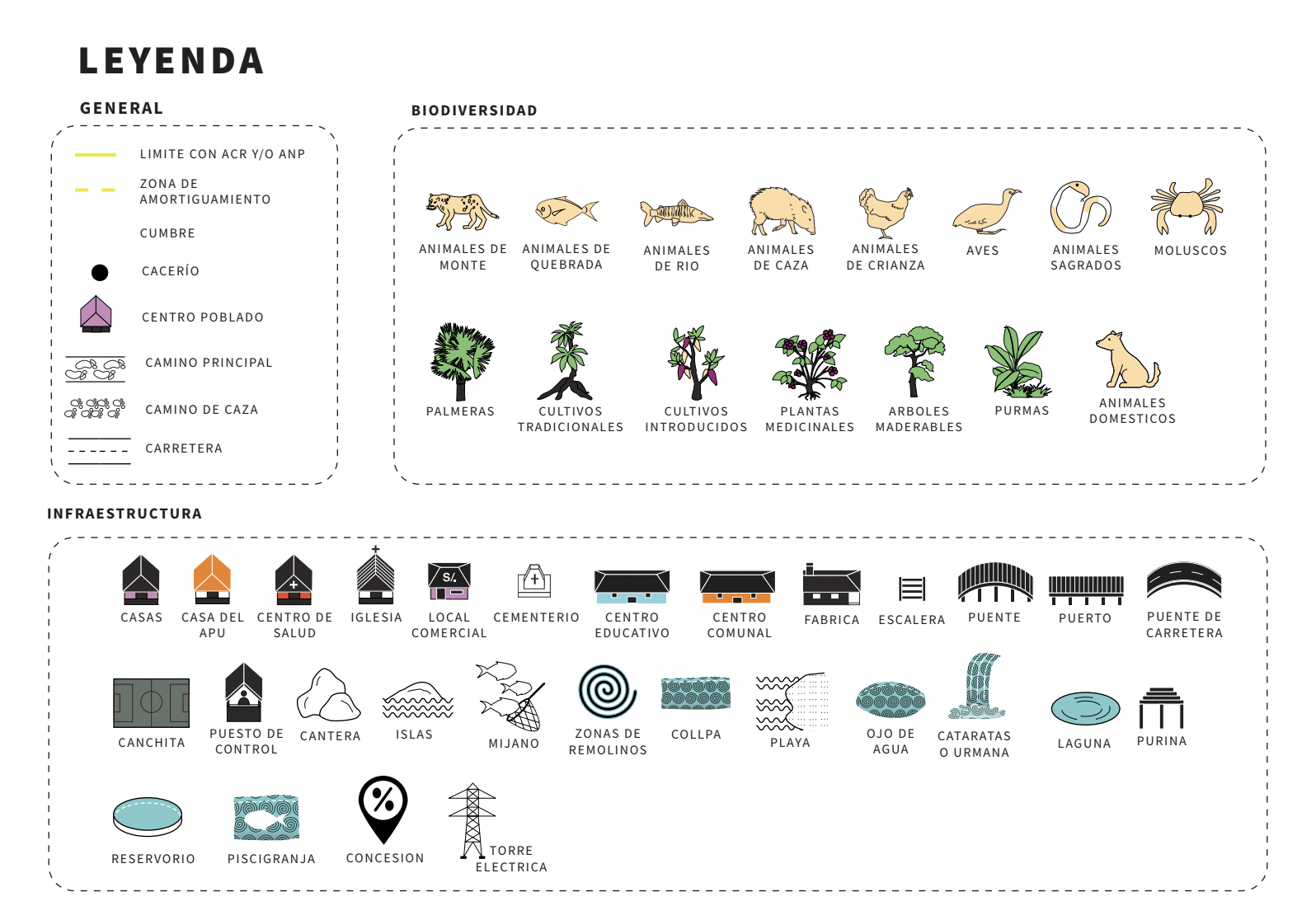
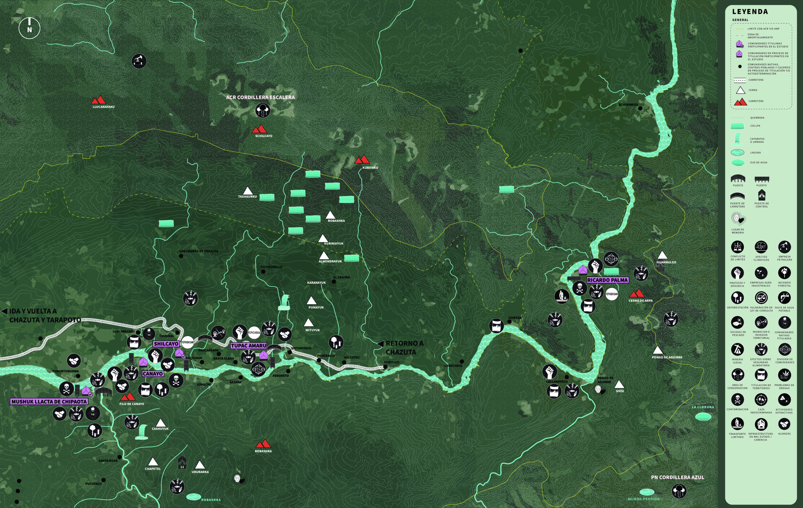
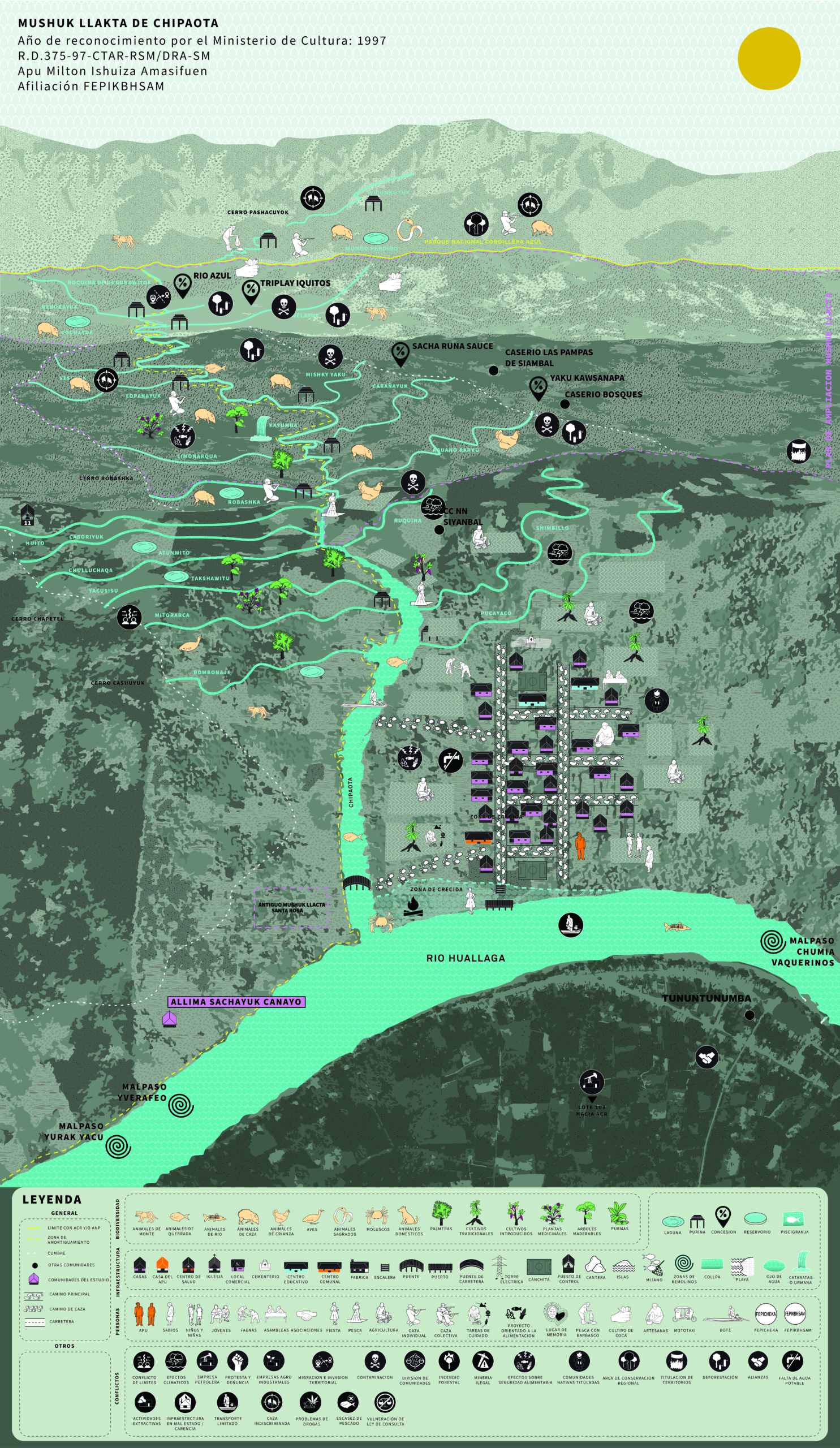
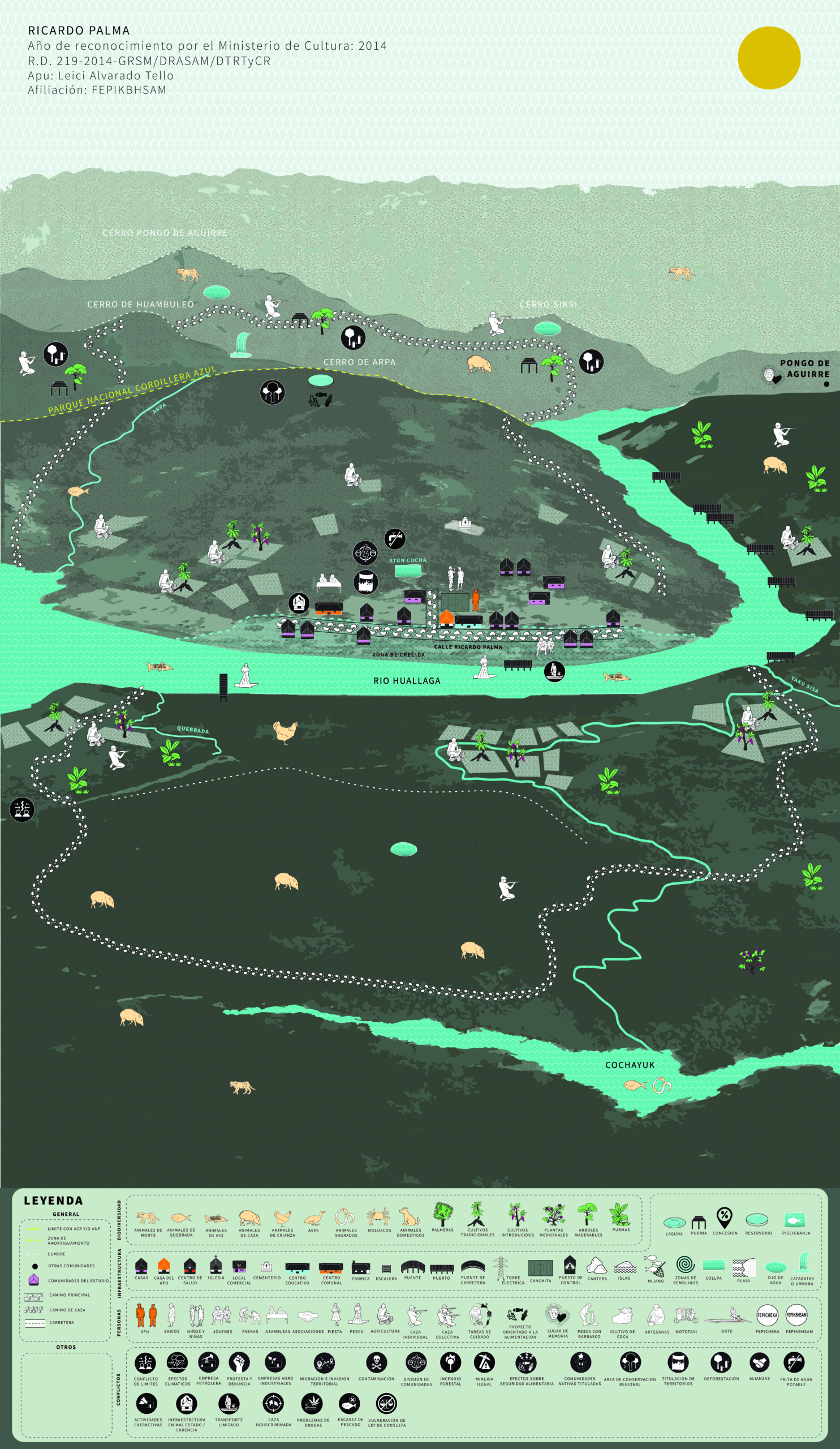
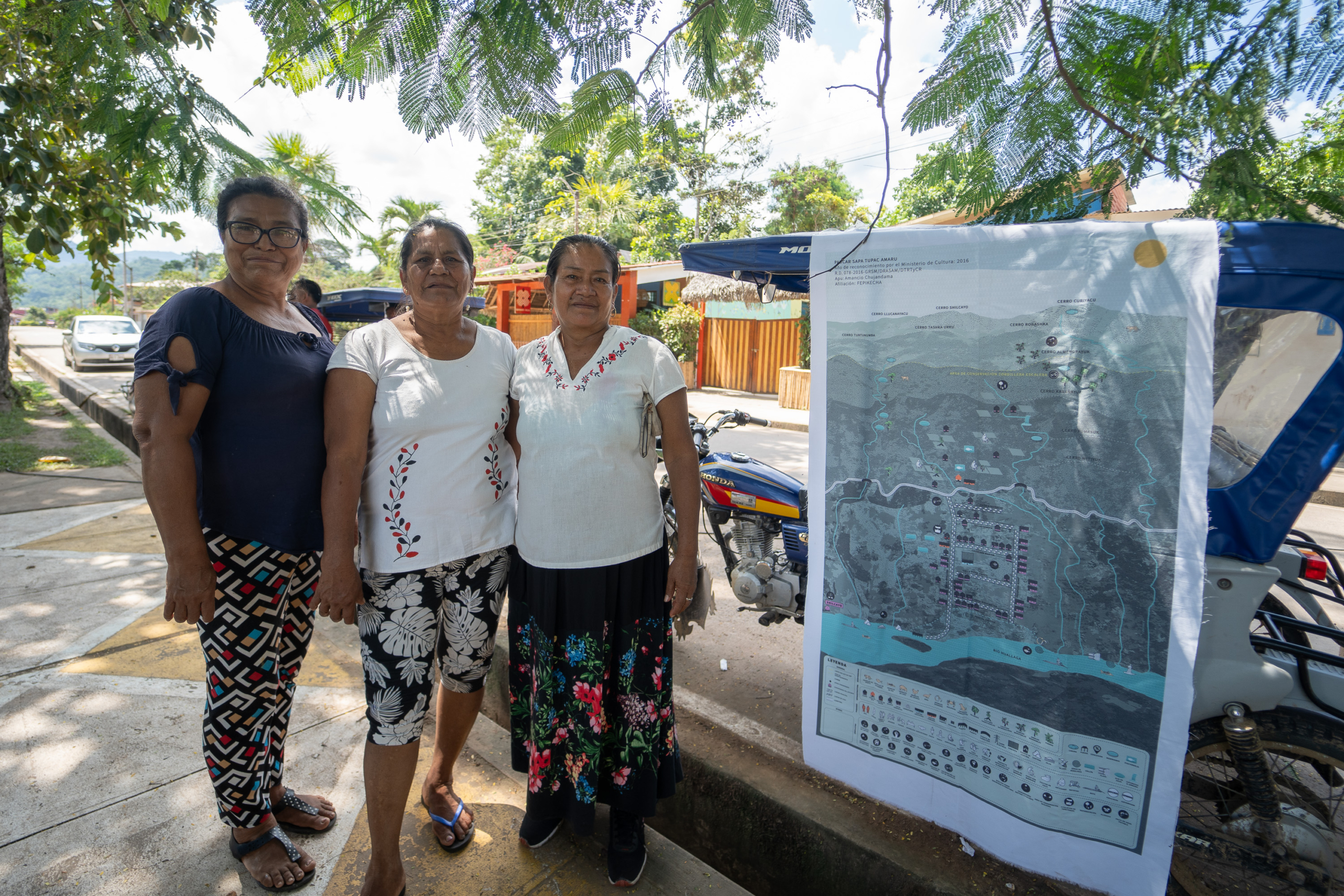
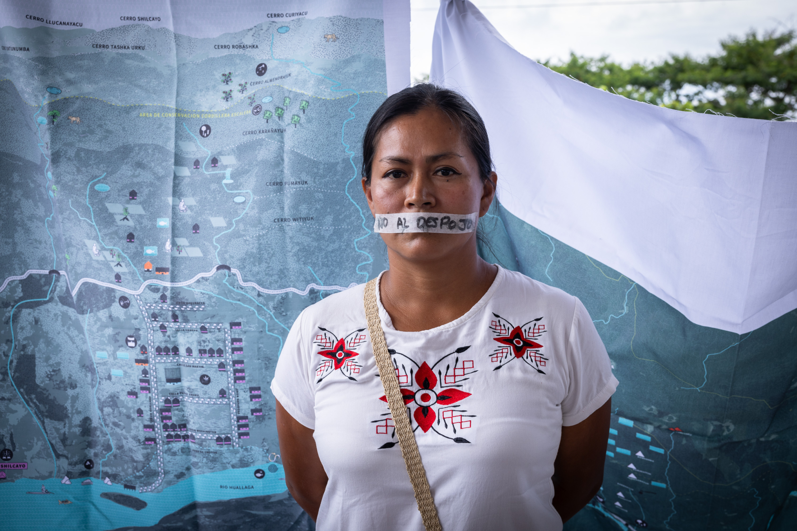
Mapeos de marzo 2023

Mapeos de marzo 2023
Mapeos de marzo 2023
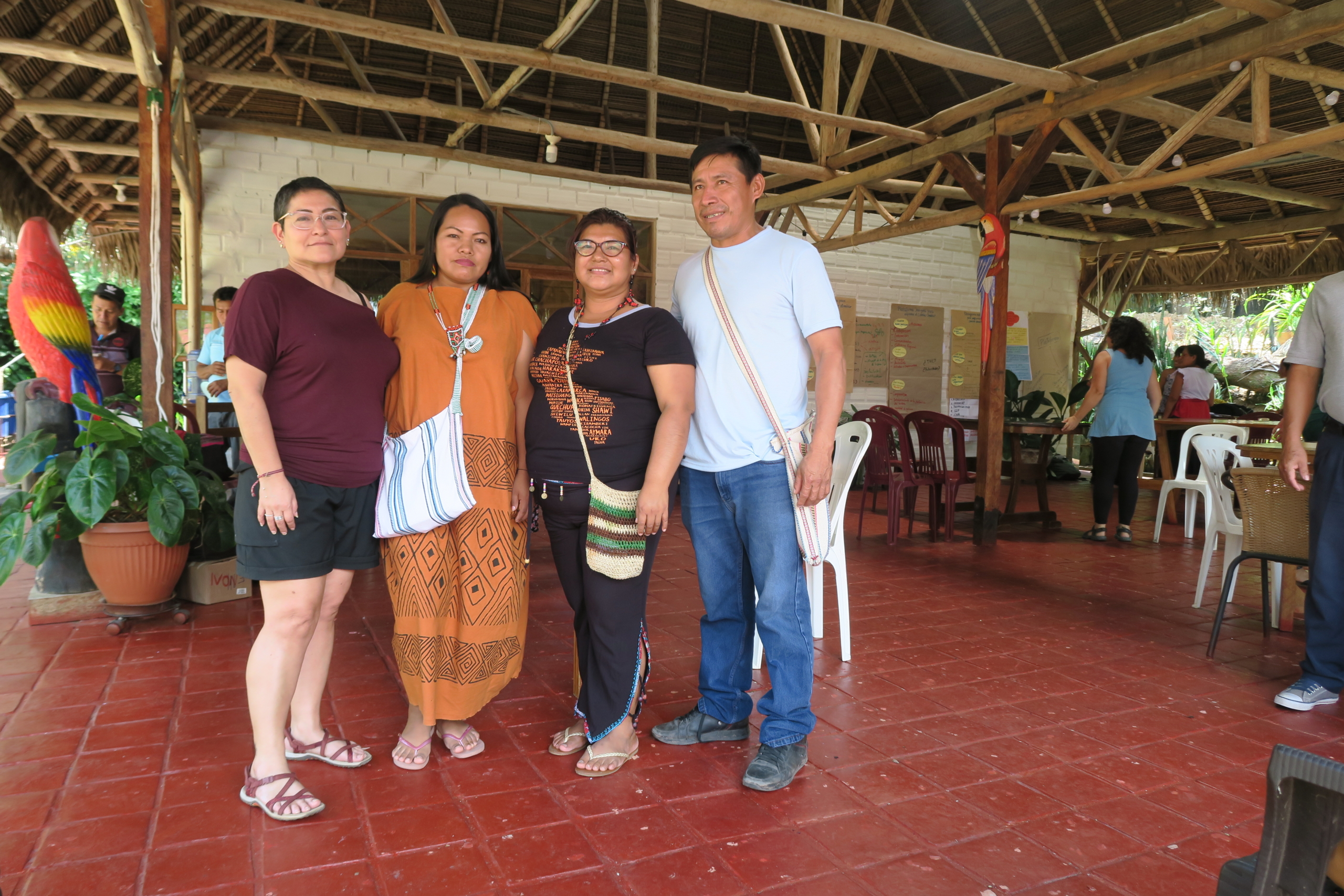
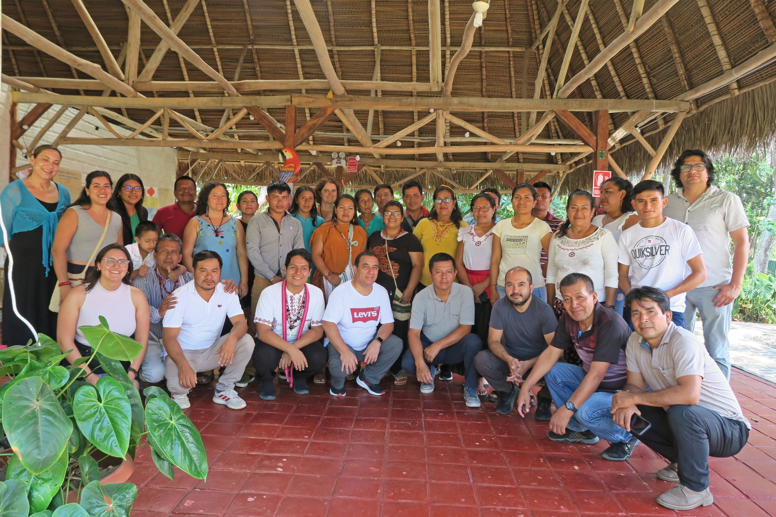
Taller subnacional del proyecto en San Martín con organizaciones indígenas regionales y nacionales (CODEPISAM, AIDESEP, ONAMIAP). Lamas, Septiembre 2023. Créditos: Valeria Soldevilla

Taller subnacional del proyecto en San Martín con organizaciones indígenas regionales y nacionales (CODEPISAM, AIDESEP, ONAMIAP). Lamas, Septiembre 2023. Créditos: Valeria Soldevilla
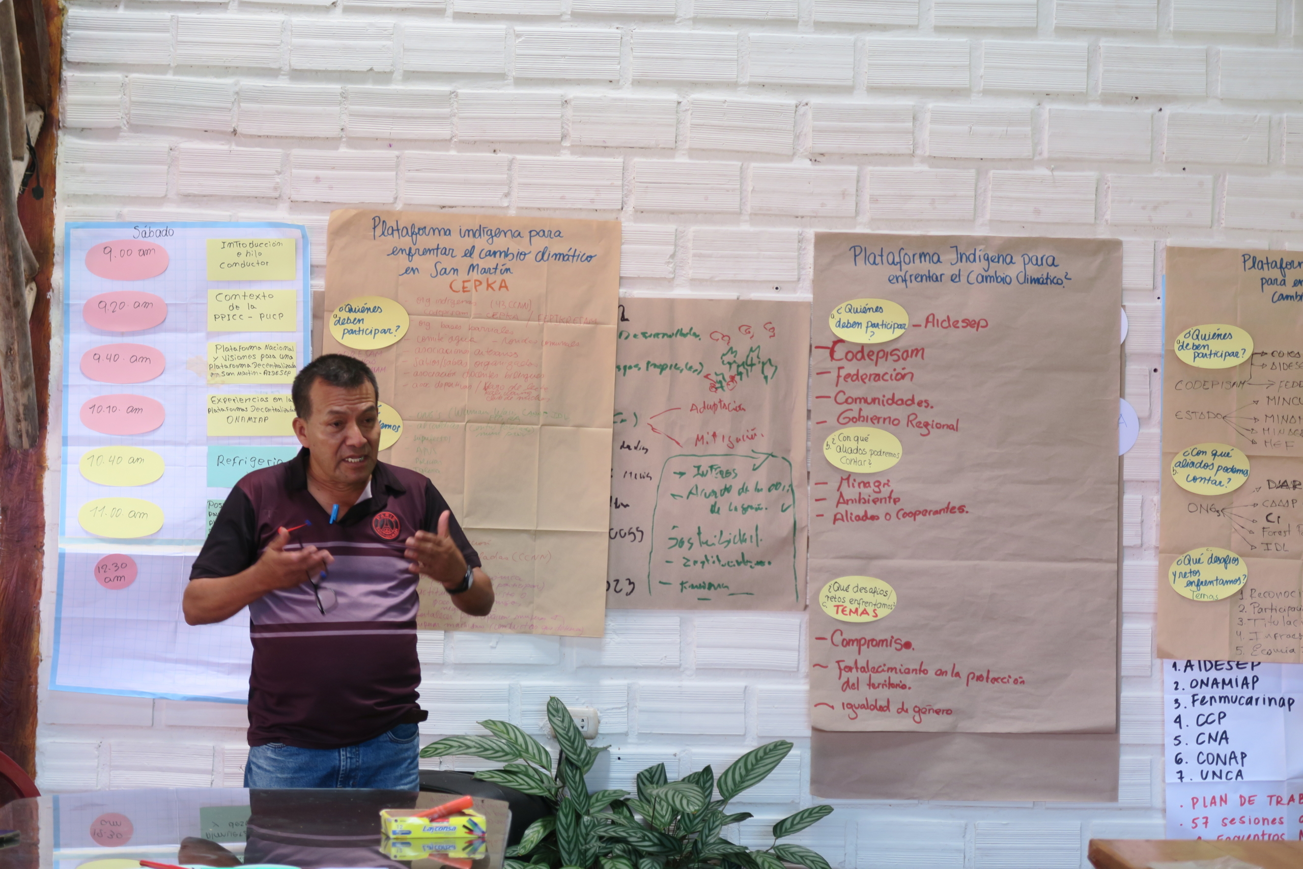
Taller subnacional del proyecto en San Martín con organizaciones indígenas regionales y nacionales (CODEPISAM, AIDESEP, ONAMIAP). Lamas, Septiembre 2023. Créditos: Valeria Soldevilla

Taller subnacional del proyecto en San Martín con organizaciones indígenas regionales y nacionales (CODEPISAM, AIDESEP, ONAMIAP). Lamas, Septiembre 2023. Créditos: Valeria Soldevilla
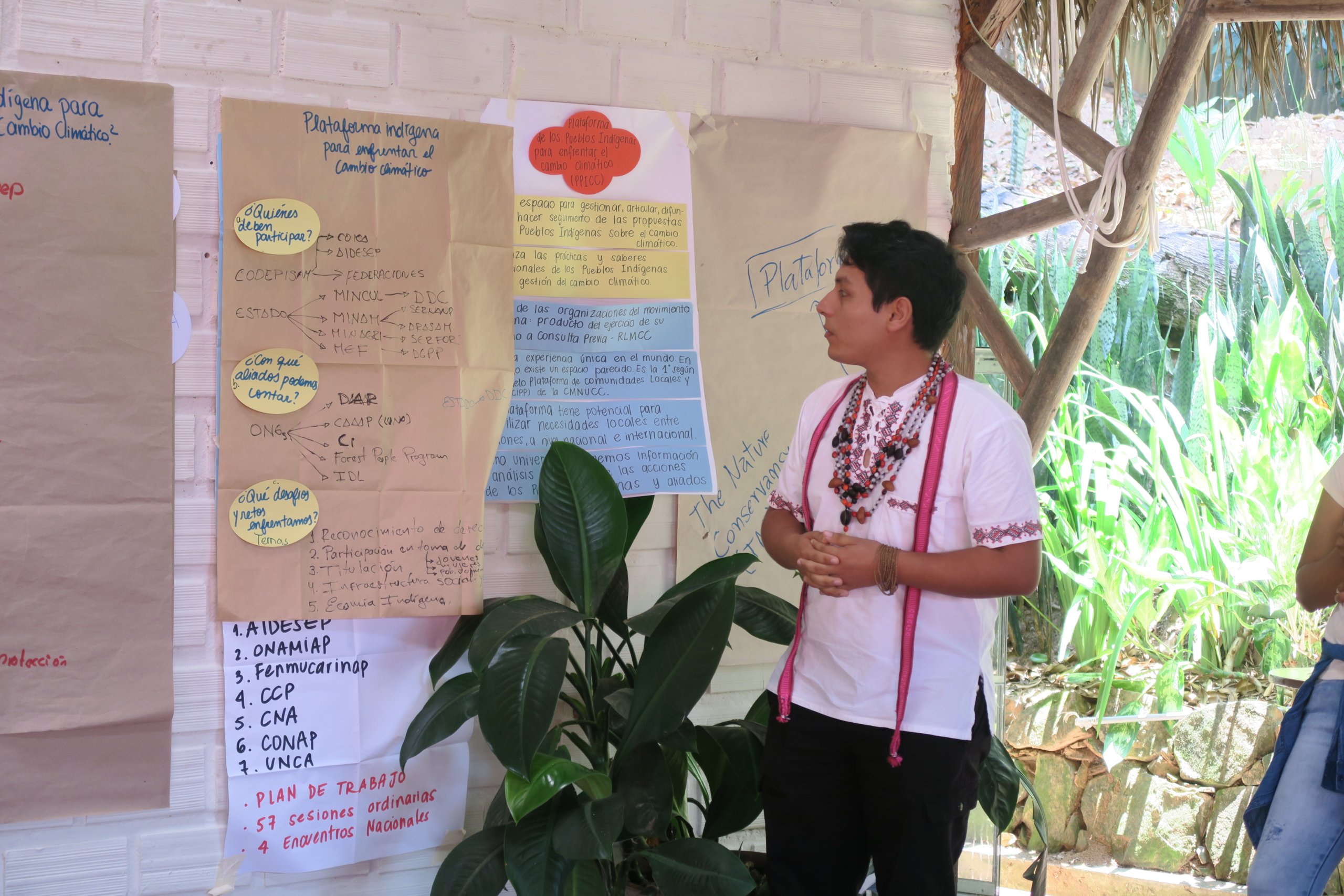
Taller subnacional del proyecto en San Martín con organizaciones indígenas regionales y nacionales (CODEPISAM, AIDESEP, ONAMIAP). Lamas, Septiembre 2023. Créditos: Valeria Soldevilla

Taller subnacional del proyecto en San Martín con organizaciones indígenas regionales y nacionales (CODEPISAM, AIDESEP, ONAMIAP). Lamas, Septiembre 2023. Créditos: Valeria Soldevilla

Taller subnacional del proyecto en San Martín con organizaciones indígenas regionales y nacionales (CODEPISAM, AIDESEP, ONAMIAP). Lamas, Septiembre 2023. Créditos: Valeria Soldevilla

Taller subnacional del proyecto en San Martín con organizaciones indígenas regionales y nacionales (CODEPISAM, AIDESEP, ONAMIAP). Lamas, Septiembre 2023. Créditos: Valeria Soldevilla

Taller subnacional del proyecto en San Martín con organizaciones indígenas regionales y nacionales (CODEPISAM, AIDESEP, ONAMIAP). Lamas, Septiembre 2023. Créditos: Valeria Soldevilla

Taller subnacional del proyecto en San Martín con organizaciones indígenas regionales y nacionales (CODEPISAM, AIDESEP, ONAMIAP). Lamas, Septiembre 2023. Créditos: Valeria Soldevilla